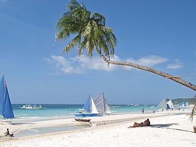
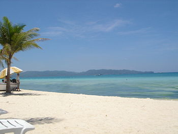
Boracay is a tropical island located approximately 315km (200 miles) south of Manila and 2km off the northwest tip of the island of Panay in the Western Visayas region of the Philippines. It is one of the country’s most popular tourist destinations. The island comprises the barangays of Manoc-Manoc, Balabag, and Yapak (3 of the 17 barangays which make up the municipality of Malay), and is under the administrative control of the Philippine Tourism Authority in coordination with the Provincial Government of Aklan.
Boracay Island is located off the northwest corner of the island of Panay, and belongs to the Western Visayas island-group, or Region VI, of the Philippines. The island is approximately seven kilometers long, dog-bone shaped with the narrowest spot being less than one kilometer wide, and has a total land area of 10.32 square kilometers.South-facing Cagban Beach is located across a small strait from the jetty port at Caticlan on Panay island, and the Cagban jetty port serves as Boracay’s main entry and exit point during most of the year. When wind and sea conditions dictate, east-facing Tambisaan Beach serves as an alternative entry and exit point.Boracay’s two primary tourism beaches, White Beach and Bulabog Beach, are located on opposite sides of the island’s narrow central area. White Beach faces westwards and Bulabog Beach faces eastwards. The island also has several other beaches.White Beach is the main tourism beach. It is a bit over four kilometers long and is lined with resorts, hotels, lodging houses, restaurants, and other tourism-related businesses. In the central portion, for about two kilometers, there is a footpath known as the Beachfront Path separating the beach itself from the establishments located along it. North and south of the Beachfront Path, beachfront establishments do literally front along the beach itself. Several roads and paths connect the Beachfront Path with Boracay’s Main Road, a vehicular road which runs the length of the island. At the extreme northern end of White Beach, a footpath runs around the headland there and connects White Beach with Diniwid Beach.
skip to main |
skip to sidebar
Bali Tourism, Beach, Phuket Beach, switzerland beach holiday, Tourist Destinations


No comments:
Post a Comment