Sunday, 30 May 2010

Nusa Lembongan Island

Nusa Lembongan, a small island between Bali and Nusa Penida in Badung Strait, is the perfect holiday hideaway with few visitors and pristine un-spoilt beaches. A low, protected island about 11 km southeast of mainland Bali, measuring only four by three km and ringed with mangrove swamps, and palms and white sandy beaches. Inland the terrain is scrubby and very dry, with volcanic stonewalls and processional avenues crisscrossing the small cactus-covered hills. Overlooking Sanghiang Bay with its clear blue waters, the Nusa Lembongan Resort offers a panoramic view of eastern Bali and the majestic silhouette of Mount Agung. Known for its great surf, the excellent crystal-clear waters also make it a perfect place for snorkeling and diving. It's still a basic place, but interesting, and there are some lovely places to stay.

The island is small enough to explore on foot, offering pristine beaches and coves, majestic views of Mount Agung, unique Balinese architecture, and the friendliness of a simple country folk. With a lack of arable land and a severe shortage of tourist attractions, the island's economy is limited to its underwater wealth-seaweed. A secondary occupation is catering to visiting surfers. Between Nusa Lembongan and the adjacent of Nusa Ceningan Island, the population is only 60,000.

There are just two villages on Nusa Lembongan, the large, spread out administrative center of Lembongan Village, and Jungut Batu village. Surfers and backpackers hang out in the latter, about 150 per month, for an average stay of three to five days. The only other visitors are European, Japanese, and Australian day-trippers on excursion boats. Jungut Batu offers the island's best accommodations and water sport opportunities. There's motorcycle traffic between the two villages and it's easy to get a lift. Both villages are heavily involved in the cultivation of seaweed. Before government-supported commercial seafood production in 1980, the people of the island lived on maize, cassava, tuber, beans, and peanuts. Today most everyone is involved in one way or another with cultivation of "sea vegetables," and the air is permeated with its smell.

Visit the seaweed gardens at low tide; they look like gigantic underwater botanical gardens. Two kinds are grown, the small red pinusan and the large green kotoni. Almost the entire crop is exported to Hong Kong for use in the cosmetics and food processing industries. After harvesting, gatherers leave a floating offering of rice and flowers that gently drifts away on the outgoing tide.

Life on Nusa Lembongan is very relaxing, with cool breezes, little traffic, no big hotels, no pollution, no stress, no photocopy machines, and hardly any telephones. Best of all, there are almost no pedagang acung (pushy vendors) and few thieves. Jungut Batu's charming "tree house" bungalow-style accommodations with outdoors open-air 'mandi', rickety wooden furniture, sand floor restaurants and offices are reminiscent of Kuta Beach 20 years ago. Crops are meager, and the only fruit available is melon. All other food must be imported from the market in Denpasar or from the neighboring island of Nusa Penida.
Gajah Cave

Goa Gajah, literally means 'Elephant Cave”. Although named by 'elephant' it doesn't mean there is any real elephant live or ever live here. The name Goa Gajah derived from 'Lawa Gajah', which is mentioned in the manuscripts that found in this site. This temple complex was built for the first time around 11 century based on epigraph found in this site.

A seven-meters deep cave with a shape of T-letter is the major attraction of this Bedulu village's local temple. The cave it self is carved in a solid stone hill of the river valley. The main figure of the carving at the cave entrance is 'boma', a barong face, accompanied with big clapping fingers on its side. Leaf, flower, and some horror figures can be noticed if we give more attention look to the rest of the carving. Some holes that are considered to be used as meditation or sleeping quarters can be found in the wall of the cave. Nowadays, those holes are used to place offerings whenever there is ceremonies taking place. On the left end side of the cave is Ganesha statue, believe it as 'the God of knowledge'. Meanwhile on the right end side can be found three 'linggas', that each of them dedicated to the three common God manifestations in Bali, Brahma, Wisnu, and Siwa. There are other three stone carvings in the centre wall, one of them figuring head and face.

Three other statues of Ganesha, demons and Men Brayut, a legendary lady with her beloved children, are placed on a high building located on the left side of cave entrance. It is considered that these statues are 1000 years old. In the middle of the complex, in front of the cave, there is bathing place that is not any longer used by the local people. The angle figures within the bathing complex are about similar to common figures found in India. On the south part of the complex, there are along flight of step leads down the lower part of the valley. After crossing a bridge above a small creek and follow another flight of steps up to eastern side of the valley, a headless sitting Buddha statue can be seen. This is the evident of a close relationship between the two religions.

List of 5 star Hotels in Goa-Location,Address & Accessibility


Goa its the beautiful place of india & attracts maximum percentage of tourism than the rest part of country. Hotels here are doing a great business over the year around.
Goa is India's smallest state by area and the fourth smallest by population. Located on the west coast of India in the region known as the Konkan, it is bounded by the state of Maharashtra to the north, and by Karnataka to the east and south, while the Arabian Sea forms its western coast. Goa is India's richest state with a GDP per capita two and a half times that of the country as a whole.

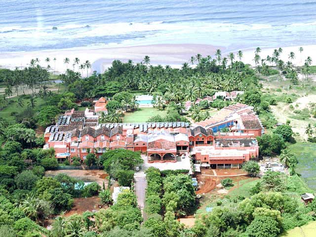
Taj Holiday Village


Address:
Sinquerim, Bardez
Goa-403519 India

Accessibility:
Dabolim Airport: 45 KM
Thivim Railway Station: 12 KM
Bus Stand: 15 KM

Taj Exotica


Address:
Calwaddo, Benaulim, Salcette
Goa-403716 India

Accessibility:
Dabolim Airport: 27 KM
Margao Railway Station: 8 KM
Bus Stand: 10 KM

Ramada Caravela Beach Resort

Address:
Varca Beach, Village - Varca, Salcette
Goa-403721 India

Accessibility:
Dabolim Airport: 30 KM
Margao Railway Station: 10 KM
Bus Stand: 10 KM

Park Hyatt Goa Resort & Spa


Address:
Arossim Beach, Cansaulim, South Goa
Goa-403712 India

Accessibility:
Dabolim Airport: 8 KM
Margao Railway Station: 14 KM
Bus Stand: 10 KM

Majorda Beach Resort


Address:
Majorda, Salcette
Goa-403713 India

Accessibility:
Dabolim Airport: 12 KM
Margao Railway Station: 10 KM
Bus Stand: 10 KM

The Leela Kempinski Goa

Address:
Mobor, Cavelossim
Goa-403731 India

Accessibility:
Dabolim Airport: 40 KM
Margao Railway Station: 7 KM
Bus Stand: 17 KM

Intercontinental The Lalit Goa Resort


Address:
Raj Baga, Canacona
Goa-403702 India

Accessibility:
Dabolim Airport: 66 KM
Margao Railway Station: 35 KM

Goa Marriott Resort


Address:
Miramar, Panaji
Goa-403001 India

Accessibility:
Dabolim Airport: 30 KM
Karmali Railway Station: 12 KM
Bus Stand: 5 KM

Cidade De Goa


Address:
Vainguinim Beach
Goa-403004 India

Accessibility:
Dabolim Airport: 28 KM
Karmali Railway Station: 14 KM
Bus Stand: 7 KM


Fort Aguada Beach Resort


Address:
Sinquerim, Bardez
Goa-403519 India

Accessibility:
Dabolim Airport: 45 KM
Thivim Railway Station: 30 KM
Bus Stand: 15 KM

5 Star Hotels, Mumbai-List of 5 star hotels,Location, Address & Accessibility-Taj,Hyatt,ITC,Trident,Leela,Oberoi,Marriott,Park,Renaissance,Four Season


Mumbai being commercial capital of india has a good number of hotels offering world class hospitality.
It is the heart of the country. It is the hub of all economical activities of the country and is the center of industry, communication and transportation.

Mumbai hotels are completely unparalleled in every aspect be it accommodation, cost, services matching the expectation of traveler. Hotels in Mumbai are well equipped with all modern amenities providing best hotel accommodation services in the world. Hotels in Mumbai comprises of different rooms including deluxe classic hotels, deluxe luxury rooms, premium luxury rooms, ocean front suite, walnut suite and many such varieties. They offer comfort, quality and great value for money.

5 Star Hotels


Taj President Hotel


Address:
90 Cuffe Parade, Colaba
Mumbai-400005 India

Accessibility:
International Airport: 35 KM
Domestic Airport: 29 KM
Railway Station: 3 KM

Grand Hyatt Mumbai


Address:

Off Western Express Highway
Mumbai-400055 India

Accessibility:
International Airport: 9 KM
Domestic Airport: 3 KM
Railway Station: 1 KM

Hyatt Regency Mumbai


Address:
Sahar Airport Road
Mumbai-400099 India

Accessibility:
International Airport: 1 KM
Domestic Airport: 5 KM

ITC Maratha


Address:
Sahar
Mumbai-400012 India

Accessibility:
Chhatrapati Shivaji International Airport: 2 KM
Domestic Airport: 5 KM
Bombay Central Railway Station: 28 KM

Trident Nariman Point


Address:
Nariman Point
Mumbai-400021 India

Accessibility:
International Airport: 27 KM
Domestic Airport: 23 KM
Railway Station: 2 KM

The Oberoi


Address:
Nariman Point
Mumbai-400021 India

Accessibility:
International Airport: 27 KM
Domestic Airport: 23 KM
Railway Station: 2 KM

JW Marriott Hotel


Address:
Juhu Tara Road, Juhu
Mumbai-400049 India

Accessibility:
International Airport: 10 KM
Domestic Airport: 5 KM

The Leela Kempinski Mumbai


Address:
Sahar
Mumbai-400059 India

Accessibility:
International Airport: 1.5 KM
Domestic Airport: 6 KM

Le Royal Meridien Mumbai


Address:
Sahar Airport Road
Mumbai-400099 India

Accessibility:
International Airport: 1 KM
Domestic Airport: 7 KM
Andheri Railway Station: 4 KM

Sun n Sand Mumbai


Address:
39, Juhu Beach
Mumbai-400049 India

Accessibility:
International Airport: 10 KM
Domestic Airport: 5 KM

The Retreat


Address:
Erangal Beach, Madh Marve Road
Madh Island
Mumbai-400061 India

Accessibility:
Sahar International Airport : 26 KM
Domestic Airport : 27 KM
Malad Railway Station : 13 KM

The Resort


Address:
11, Madh Marve Road
Aksa Beach, Malad (West)
Mumbai-400095 India

Accessibility:
International Airport : 23 KM
Domestic Airport : 23 KM
Railway Station : 10 KM

Intercontinental The Lalit Mumbai


Address:
Sahar Airport Road, Andheri (East)
Mumbai-400059 India

Accessibility:
Sahar Airport: 2 KM
Domestic Airport: 7 KM
Andheri Railway Station: 5 KM

Intercontinental Marine Drive


Address:
135, Marine Drive
Mumbai-400020 India

Accessibility:
International Airport: 27 KM
Domestic Airport: 17 KM
Railway Station: 1 KM


The Taj Mahal Palace & Tower


Address:
Apollo Bunder, Colaba
Mumbai-400001 India

Accessibility:
International Airport: 32 KM
Domestic Airport: 23 KM
Railway Station: 2.5 KM

Four Seasons Hotel (Worli)


Address:
114, Dr. E. Moses Road, Worli
Mumbai-110018 India

Accessibility:
Chhatrapati Shivaji Airport: 60 Minutes
Santa Cruz Airport: 45 KM

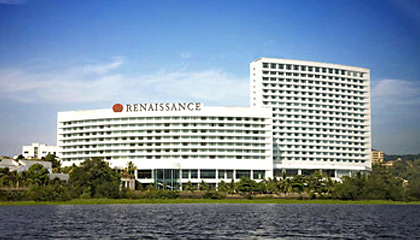
Renaissance Mumbai Hotel


Address:
2 & 3B, Near Chinmayanand Ashram
Powai
Mumbai-400087 India

Accessibility:
Chhatrapati Shivaji International Airport: 5 KM
Mumbai Domestic Airport: 9 KM

The Park Navi Mumbai


Address:
No 1, Sector 10
CBD Belapur, Navi Mumbai
Mumbai-400614 India

Accessibility:
Chhatrapati Shivaji International Airport: 42 KM
CBD Belapur Station: 1 KM
Chhatrapati Shivaji Terminus: 41 KM

ITC Grand Central Mumbai


Address:
287, Dr. Babasaheb Ambedkar Road, Parel
Mumbai-400012 India

Accessibility:
International Airport: 22 KM
Domestic Airport: 15 KM

Batur Lake

Batur Lake is the old crater of Mount Batur, a still active volcano next to it. It is located on the northern part of Bali. The largest lake overshadowed by the active volcano is located in Bangli Regency, at the northeast of Bali. Batur Lake is the widest lake in this island. It lies down in the feet of Mount Batur and Mount Abang. The lake is classified as a "neutral-dilute" lake because there is no known underlying hydrothermal activity, and the abundant rainfall more than quenches any such activity. There is a hot spring right by the lake. We can enjoy the spectacular scenery of Batur Lake from Kintamani. Across the lake, only reachable by boat, lies Trunyan village, where the Bali Aga people live. The surrounding of the lake is a favorite place for picks self up.

At Batur Lake we can see the scenic view and feel cool atmosphere. Bangli's mountainous region center is around the spectacular volcanic crater (or caldera) of Batur. Mount Batur adjacent to the volcano is the large crescent-shaped Batur Lake, all surrounded by the high walls of the crater rim. The place is a great day trips, trekking or just to get away from the daily activity.

Mount Batur itself is actually just a small volcano, but sets in the heart of a huge crater 14km in diameter. Adjacent to the volcano is the large crescent-shaped Batur Lake, all surrounded by the high walls of the crater rim. As the road rises steadily from Bangli or Tampaksiring, nothing in the surrounding gray landscape of bushes and garden plots suggests the presence of a volcano. But over one more small ridge a dizzying view awaits the ayes, encompassing the crater and beyond. From Panelokan, the main road runs right round the rim towards Kintamani, the panorama shifting as we circle around the crater.

One very interesting excursion in Batur is the climb down the inside of the crater from Penelokan to Kedisan. We can then drive around the smaller Mount Batur, through Songan. From Toya Bungkah, boats cross the lake to a Bali Aga village called Trunyan. This place is notorious for its mortuary traditions. Instead of cremating the dead, as Balinese do throughout most of the island, the Trunyan communities leave the bodies to decompose naturally in a special cemetery.

Saturday, 29 May 2010

Jog Fall India : highest waterfall-How to reach,Best time to visit,Power project,Tourist attraction,Nearby places to visit,Pictures


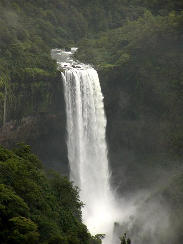
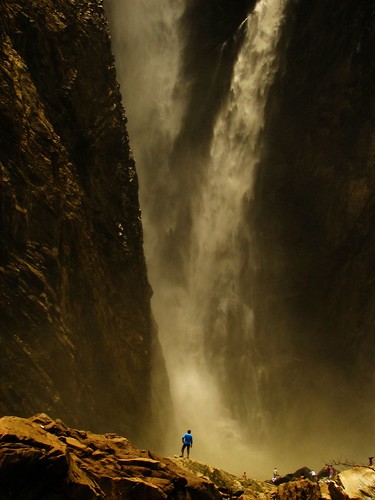
Jog Fall located at southern state of Karnataka is India's highest waterfall. Its height is 830 feet and is located on Sharavati River.The tallest and no doubt the most impressive waterfall in India, the Jog Falls(also known as the Gerusoppa waterfalls) is located about 400 kms from Bangalore in Karnataka. It is created by the Sharavathi River which comes down in cascades from a height of 292 meters at Gerusoppa in four distinct falls, called the Raja, Rani, Rover and Rocket.

How to reach Jog Falls

Jog Falls in Karnataka is a major tourist attraction of South India and visited by tourists all throughout the year. So, this place is well linked via proper roadways and railways. The nearest town to Jog falls is Sagar which is well connected with bus and trains and the nearest railhead is Shimoga, 113 kms away. Regular buses leave for Jog Falls. If you are on road, you have to travel on the national highway for about 7 to 8 hours to reach Jog falls.


Best Time To Visit

For a Tour to Jog Falls, the best time to visit is between the months of August and December.

Significance-Power Project

The power station has been operational since 1948, and is of 120 MW capacity, one of the largest hydro-electric stations in India at that time and a small source of electric power for Karnataka now. The power station was previously named Krishna Rajendra hydro-electric project, after the King of Mysore at that time. The name was later changed to Mahatma Gandhi hydro-electric Project.

Tourist Attractions

  • Honnemaradu: Situated on the back waters of River Sharavathi, this island formed with the backwater of Linganmakki Dam is famous for water sports.
  • Tunga Anicut Dam: Situiated 15 km from Shimoga, this dam was built across the river Tungabadra. You can enjoy boat trips around the lake.
  • Lion Tiger Reserve: This Lion - Tiger Reserve / Safari is located nearly 12 km from Shimoga towards Jog Falls.

Nearby Places to visit:

  • Sagara: A small town in the district of Shimoga, located 30 km from Jog Falls, Sagara is home to several ancient temples.
  • Siddapura: a small town in Kodagu district, Siddapura lies in Western Ghats, providing captivating views of the Sahyadri mountain ranges.
  • Sirsi: A town in Uttara Kannada district, Sirsi is like a hill-station set amidst emerald green forests and several waterfalls.


Dudh Sagar waterfall,Goa-Location,Best time to visit,India's one of the tallest,Transport,Natural Beauty,Pictures


Best Season

The fall is generally calm durin summers. During monsoon, the falls become alive and attracts tourists mostly during monsoon season.

Location


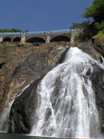
The Dudh Sagar waterfall is situated in the Indian state of Goa around 60 km off Panaji, the capital of the state. It is connected to the other places in the state like Panaji and Margao with a road and railway network

The falls lie high up in the Mandovi River's watershed and so are not particularly spectacular during the dry season. During the monsoon season however, the falls are transformed into one of the most powerful falls in India. Dudhsagar Falls is listed as India's 5th tallest waterfall,and is 227th in the world at 310 m.


Situated on the border of Goa and Karnataka, the Dudhsagar Waterfalls takes a steep plunge 2000 feet down in the wooded mountains of the western Ghats

The water plummets hundreds of feet in large volumes during the monsoon season, forming one of the most spectacular natural phenomena in Goa. It is a major part of the Goa ecosystem.This is a four tiered waterfall with a total height of 310 meters (1017 feet) and an average width of 30 meters (100 feet)


Transport

The waterfall is accessible by train and rough road. It is 10 kilometers from Kulem Railway Station (Indian Railway station code QLM).


Natural beauty

Swimming is a good options at the bottom of the falls. But one has to make sure that the water is calm in desired area. The sure-footed adventurers could try and climb up to the head of the falls through bushes, boulders and water. It’s a tough climb which takes at least a couple of hours. The fall's surrounding area form a good picnic spot. While visiting Dudhsagar falls, one should ensure that at least entire day is spent near the falls


Friday, 28 May 2010

Diu Beach(Gujarat)-Location,How to reach,Introduction,History,Main attraction-Beaches,Church,Forts.


Diu is well known for its beautiful beaches. Diu is located at 125 kms from Junagadh.


How to Reach to Diu :

By Air :
The nearest airport of Keshod connecting to Mumbai via Porbandar and Rajkot.
By Rail :
Veraval is the nearest railway station to reach Diu. Diu is well connected to Rajkot , Veraval and Ahmedabad by rail.
By Road :
State transport buses and private luxury and semi luxury buses are available from all major cities of Gujarat.

Introduction:

Diu District is an island lying off the south coast of Gujarat's Kathiawar peninsula, separated from the mainland by a tidal creek. It has an area of 40 km².The town of Diu lies at the eastern end of the island, and is famous for its fortress and old Portuguese Cathedral. It is also a fishing town


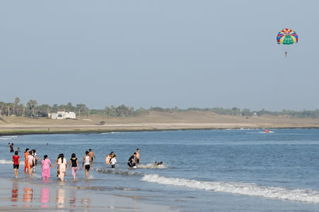
Diu is famous for exotic liquors on golden sandy beaches, dense palm groves and historical monuments. It is the beautiful tiny island with a coastal length of 21 kms. Chakratirth beach at Diu has beautiful landscaped gardens, open air-auditorium and changing rooms. Other famous beaches at Diu are the Kevdi, Gomatimala, Goghla, and NaGoa beach

History:

In 1535 Bahadur Shah, the Sultan of Gujarat, concluded a defensive alliance with the Portuguese against the Mughal emperor Humayun, and allowed the Portuguese to construct the Diu Fort and maintain a garrison on the island. The alliance quickly unravelled, and attempts by the Sultans to oust the Portuguese from Diu between 1537 and 1546 failed. The Siege of Diu by the Ottoman Empire in 1538 was unsuccessful to repel the Portuguese. The fortress, completed by Dom João de Castro after the siege of 1545, still stands. The island was occupied by the Indian military on 19 December 1961.

Main Attraction:

  • Diu Fort: Among all the places, the Diu fort has a prominent position in the places of tourist interest. It is a huge and impressive structure. It was constructed between 1535 and 1541 by the Portuguese, the fort has gorgeous view of the sea and Panikotha. You feel the history and battle fought by gallant soldiers.
Diu Fort - Diu, Daman and Diu

  • Chakrateerth beach: although no watersports and other activities are available, you can love the sandy beach. It has a beautiful sunset point and a memorial of Indian battleship INS Khukri which was destroyed by Pakistan in the 1971 war (It was the only Indian ship destroyed by Pakistan in the battle)
  • Nagoa beach: is a horseshoe shaped beach with various water sports facilities.
  • Ghoghla beach: is the largest and gentlest beach of Diu. You can do swimming, sunbathing, parasailing, surfing etc.
  • Gangeshwar Mahadev: Gangeshwar Mahadev is 3 kilometers from the Jethibai Bus Terminus of Diu. This beautiful and sacred place has 5 shiv-lingams. The Shiv-lingam gets an abhishek by the ocean when it is on high tide. The legend is that the Pandavas worshipped load Shiva here during their exile.
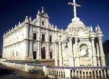
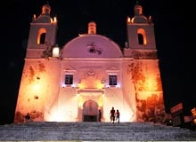
  • St.Paul's Church
  • St.Francis Church
  • St.Thomas Church
  • INS Khukri Memorial:It was inaugurated on 15th December, 1999 in memory of the heroic sailors and officer who chose not to stop fighting and leave ship until it completely sank. INS Khukri was a frigate of the Indian navy
  • Sea Shell museum: A unique and amazing museum for lovers of ocean life.
  • Fortim-do-mar (Pani kotha)

Sunset At Diu


Blog Archive